
Mission and objectives
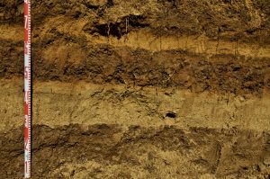 This project will contribute to the understanding of the morphodynamic and hydrodynamic processes linked with tsunami waves impinging on Portuguese sandy coasts and by analogy in other similar settings worldwide. It must be underlined the pioneering character of the multidisciplinary approach to be followed that will allow to gather data to solve the overarching goal of this project: to fully reconstruct tsunami events and their impacts at the coast based in geological evidences, in particular the still intriguing AD 1755 tsunami (e.g. tsunami studies can contribute to a more specific definition of the earthquake epicenter).
This ground-breaking project has a threefold purpose: a) to retrieve information from the sedimentological record to recreate past tsunami events; b) to model the hydrodynamic and morphodynamic changes caused by tsunami events; c) and, lastly to produce an output that can be beneficial to society by producing tsunami inundation scenarios that can support the management of sandy coastal areas by governmental authorities.
The data to be gathered will contribute to the production of probable scenarios for tsunami inundations but also to a better definition of recurrence intervals for the coast of Portugal (which is the most active tsunamigenic region of the Atlantic). Furthermore, values of sediment volume displaced by the AD 1755 will be made available to coastal management authorities to more accurately recognize hazards affecting their areas of interest and eventually better define setback requirements.